Current calculated and estimated location that can be based on GNSS and related navigation sensors. This message does not contain the individual sensor values of the sensor technology. More...
Public Attributes | |
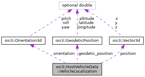
| optional Vector3d | position = 1 |
| optional Orientation3d | orientation = 2 |
| optional GeodeticPosition | geodetic_position = 3 |
Detailed Description
Current calculated and estimated location that can be based on GNSS and related navigation sensors. This message does not contain the individual sensor values of the sensor technology.
This message contains the most accurate information the vehicle knows about its position available in the on-board network. Because of this the values can differ from the "true" values calculated out of GroundTruth::proj_string, GroundTruth::MovingObject::BaseMoving::position, GroundTruth::host_vehicle_id.
Member Data Documentation
◆ geodetic_position
| optional GeodeticPosition osi3::HostVehicleData::VehicleLocalization::geodetic_position = 3 |
Most accurate geodetic information of the vehicle available in the on-board network.
◆ orientation
| optional Orientation3d osi3::HostVehicleData::VehicleLocalization::orientation = 2 |
Most accurate orientation information of the vehicle available in the on-board network in context to the global coordinate system.
◆ position
| optional Vector3d osi3::HostVehicleData::VehicleLocalization::position = 1 |
Most accurate position information of the vehicle available in the on-board network. The reference point for position, that is, the center (x,y,z) of the bounding box in context to the global coordinate system.
The documentation for this struct was generated from the following file:
- osi_hostvehicledata.proto