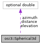
A spherical representation for a point or vector in 3D space. More...

Public Attributes | |
| optional double | distance = 1 |
| optional double | azimuth = 2 |
| optional double | elevation = 3 |
Detailed Description
A spherical representation for a point or vector in 3D space.
Used e.g., for low level representations of radar detections.
Azimuth and elevation are defined as the rotations that would have to be applied to the local frame (e.g sensor frame definition in SensorDetectionHeader) to make its x-axis point towards the referenced point or to align it with the referenced vector. The rotations are to be performed azimuth first (around the z-axis) and elevation second (around the new y-axis) to follow the definition of Orientation3d. For the sense of each rotation, the right-hand rule applies.
\( vector_{cartesian} := Rotation( \) elevation \( )*Rotation( \) azimuth \( )* (Unit_{vector_x}* \) distance \( ) \)
Member Data Documentation
◆ azimuth
| optional double osi3::Spherical3d::azimuth = 2 |
The azimuth (horizontal) angle.
Unit: rad
◆ distance
| optional double osi3::Spherical3d::distance = 1 |
The radial distance.
Unit: m
\rules is_greater_than_or_equal_to: 0 \endrules
◆ elevation
| optional double osi3::Spherical3d::elevation = 3 |
The elevation (vertical) angle.
Unit: rad
The documentation for this struct was generated from the following file:
- osi_common.proto